Sunday, May 28, 2017

No Name Harbor, Key Biscayne to Boot Key Harbor, Marathon, FL, AICW mm 1096


May 22-23

The trip from No Name Harbor to Marathon is about 115 miles, so it would take us about 13 hrs if we could cruise at 9 mph.  First light would be around 6:15 am and last light around 8:30 pm, making for about 14 hrs of daylight at this time of year and not leaving much leeway.  We set an alarm so that we would have enough time to check the weather and sea conditions one last time, take Sasha to shore, and still weigh anchor by first light.  Our weather window was forecasted to be closing up by the end of the day, so we had to decide whether to go ahead and leave as planned or whether to stay another 5 days or so for the next window.  Since Florida Bay was still forecasted to be calm, we decided that we could duck inside at several points if conditions got too rough for us.

We thought we were doing well to leave by 6:15 am, but the sailboat in the anchorage left about 20 minutes before us.  We had read that the inlet at No Name Harbor could be a bit bumpy, so we were glad to be going through it in good light.  Wave heights were about 3 ft at 4 second intervals, so it was, indeed, a bit rolly after we turned to head more south since the waves were on our beam.  Conditions smoothed out around 8 am as forecasted, so we started to settle in for a nice, uneventful cruise.

Just about that time, I noticed something in the water directly ahead, bobbing up and down.  At first I thought that someone had lost a life jacket or fender, but since it looked like 2 separate components at times, I thought “Oh great, the only crab pot in this area and we’ve programmed our course to go right over it!”  I changed course to dodge around it, swinging wider as we got close enough to recognize exactly what it was.  Apparently, during sea turtle nesting season, the turtles mate right offshore and then the females go ashore to lay their eggs a few weeks later.  So from March 1 to October 31, if you see something bobbing on the surface a few miles offshore, you may be able to see turtles mating, just as we did.  We saw 3 pairs within a couple of hours, and I think we could have gotten closer if we had slowed down, but we didn’t want to disturb them.
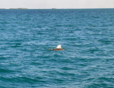
We didn't get a very good picture of the mating turtles, but you can see why it would be hard to figure out what they were until you were closer.
Hawk’s Channel runs about 2-4 miles offshore, so you are always within sight of land.  Boat traffic was light in both directions, so we only passed by other boats 3-4 times an hour.  Some of them traveled quite fast, able to make the same trip as we in 2-6 hours, but we don’t really envy them since they burn through a lot of fuel in order to do so, and probably miss seeing things like mating turtles.  We also saw a lot of fishing boats and dive boats going in and out at inlets, but they zipped across our path before we even got close to them.
Large boat headed south too
We were approaching Channel 5, one of the inlets into Florida Bay that can accommodate larger boats, so we had to make a decision about whether to continue on the ocean or whether to go into Florida Bay.  The wave heights had only gotten a bit bigger – 1-2 ft rather than the 0.5-1 ft we had been enjoying most of the day – so we would still be comfortable if they didn’t get too much bigger.  We still had about 4 hours to go, however, so since the waves were forecasted to get to at least 3 ft and were on our beam, we decided to head into Florida Bay through Channel 5.
Channel 5 Bridge
The water depths in Hawk’s Channel had been 10-20 ft, while depths in Florida Bay along the AICW at MLW (mean low water) could be as low as 6 ft, according to our charts.  Since Lorelei IV only drafts about 4.5 ft and the tide was rising, we were reasonably confident that we wouldn’t run aground as long as we stayed in the channel in areas of lower depths on our charts.
NOAA chart showing the relatively shallow depths of Florida Bay near Marathon
The water in Florida Bay was calm and smooth compared to the Atlantic, and depths were 6.5-8 ft for the most part, so we were glad that we had chosen to finish our trip on the inside.  As we were passing under the Channel 5 Bridge, a fisherman in a nearby boat got a good-sized fish on that took his line was across our path.  Another person in the boat was backing it up to follow the fish, so we almost came to a stop for a minute or so until they could get clear.  It would have been cool to hang around to see if he was successful in catching the fish and what kind it was, but since we didn’t want to run out of daylight, we got underway again as soon as the way was clear.

We had a few somewhat anxious moments when the depths dropped as low as 5.2 ft at a couple of narrow passages in the channel, but since this lasted only a few seconds and then quickly got deeper again, we figured it was just a little sand shoaling in areas that are apparently prone to it.  The only other excitement we had was when a pod of dolphins came to play in our wake for a while, and we could see them very well due to the great water clarity and relatively shallow depth.
Dolphins playing in our wake
7 Mile Bridge was our landmark for nearing the end of our trip and we could see it for a quite a while before we finally reached it.  Once we passed under its tall span, the water got a little rougher, once again confirming for us that we had made a good decision to travel on the inside for the last few hours of our trip.  Once we were in the approach channel for Boot Key Harbor, the water calmed down again, making for an easy entry.  The channel through the Harbor to the Marathon City Marina mooring field is well-marked, so we had no trouble finding our way.
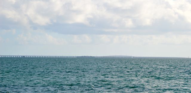
7 Mile Bridge
The City Marina does not accept reservations for moorings, assigning them on a first come, first serve basis when boats are actually in the Harbor.  Since we would be coming in after the office was closed, we were told to call back a few minutes before 5 pm.  If there was still a mooring available for our size boat, then they could assign us one at that time.  Fortunately for us, since many boats head north for hurricane season, there were 3 moorings available in the part of the field that can accommodate boats larger than 45 ft.  Even though we thought that our mooring would be in the first row that we would come to, we were confused for a moment, because one of the buoys marking the edge of the mooring field was close to that row and had a different letter on it.  We finally saw the ‘W’ that we were looking for when we looked closely at the first mooring ball in the row.  We were assigned to W-5, so then it was just a matter of making our way down the fairway until we found it.  Rob had no trouble picking up the pennant, passing our 2 lines through the eye and securing them before the boat even had a chance to drift back on them.  It’s so nice when we look like we actually know what we’re doing!
Lorelei IV on mooring ball W-5
One nice thing about being on a mooring ball is that we don’t have to wait to make sure we are secure like we do when we anchor.  Since it would be getting dark shortly, we quickly deployed the dinghy and took Sasha for her walk ashore.  There is a nice park close to the marina, so we found a nice patch of grass for a Frisbee session.
One of the dinghy docks at Marathon City Marina
We got all checked in at the office the next morning, getting our welcome bag, dinghy tag, and parking tag for our truck.  It was just a short walk to the storage lot where we had put the truck a couple of weeks before, and along the way we found another small park as a back-up for Sasha in case the one near the marina is too busy.
Sasha loves to play Frisbee
We have to make her take breaks when she looks like she's getting hot

Thursday, May 25, 2017

Singer Island to No Name Harbor, Key Biscayne, AICW mm 1096


May 20-21, 2017

Rob had been keeping an eye on a weather window for traveling from Key Biscayne to Marathon on the outside (on the ocean) via Hawk’s channel.  The AICW does go through the more protected waters of Florida Bay, on the west side of the Keys, but it is recommended that boats with more than 4.5 ft of draft take Hawk’s Channel.  While Lorelei IV’s draft is somewhere between 4.2 and 4.5 ft, -- meaning we should be okay to stay on the AICW through the Keys – the sea is whimsical and shoaling does occur, so we are more comfortable with charted depths of more than 8 ft.  Since the weather window did not seem to be opening up until Monday, May 22, we decided to stay at Singer Island another day so that we could get another dive in at the Blue Heron Bridge.
We like to see as much white as possible in the area we will be traveling in (Screen shot of Passageweather.com)
High tide wasn’t until 4:22 pm, so we had time to fill our tanks with our small high-pressure compressor, which can fill an 80 cu ft tank from 500 psi to 3000 psi in about 22 minutes.  We have to run our 12 kW generator in order to use the compressor, but we figure it’s still economical to use it versus renting tanks.  If we figure approximately 2.7 air fills per hour at even $5 per hour as a generous margin for fuel and maintenance costs, that’s less than $2 per tank.  Since typical air fills are around $6-10 and tank rentals around $10-15, that’s quite a savings, not to mention the convenience.  We have 5 scuba tanks aboard, but we used them all in Daytona, between diving the boat and teaching class, and didn’t have them all filled back up yet.

Since it was a Saturday, the area around the island was very busy with boat traffic, with boats being launched at the park’s public boat ramps and boats cruising up and down Lake Fort Worth.  It was a bit more rocky and rolly than the previous day but tolerable.  Most of the boats were relatively smaller boats, and the larger ones generally waited to ramp up their speed until they were mostly past the anchorage.  One very large boat, however, did not wait and waked us all severely.  With the wind and the current, most of the boats were positioned so that the wake hit almost directly on the beam, so boy did we rock and roll!  We leave the galley hold open while we are pumping air so that the compressor has plenty of air circulation since it generates quite a bit of heat while operating.  We rolled so badly that our captain’s chair and hi-lo table tipped over in the salon, things fell off of the counters, and our microwave in the galley hit the floor again – or would have hit only the floor if the hold had not been open.  Since the hold was open, it hit the edge of the opening before tumbling to the bottom of the hold, putting a huge dent in it, springing the door, and shattering the glass turntable inside.  Thanks goodness Rob had not been in the hold working with the compressor and that no one was in such a position to be flung overboard!

After we got things cleaned up, we debated whether we should stay put, leave the anchorage, do the dive, or not do the dive.  We hated the thought of Sasha being onboard alone if it happened again.  We decided that since it had only happened once in the 24 hrs or so that we had been there and since boats had been anchoring here for a long time, it was likely just a “perfect storm” kind of thing that did not happen very often.  Otherwise, surely people would have complained enough that officials would have extended the No Wake Zone to include the anchorages before now.

We decided not do the Big Bridge dive site due to all of the boat traffic – perhaps we would come back another time and dive it on a weekday.  We decided also to walk over to the beach this time so that we would have the tide with us for at least the first part of our dive.  Additionally, we had not seen much of the snorkel trail’s artificial reef structures on our first dive and wanted to see those as well.  The snorkel trail had a good variety of fish around the structures, but the water was shallow and murkier, probably due to all of the swimmers and snorkelers in the water.  Another negative thing about the trail was that the swimmers and snorkelers didn’t seem to be as respectful of the artificial reef structures, often standing on them or diving down and grabbing and poking at them and the fish.  We did see a juvenile green moray eel, a first for us, but we quickly had our fill of the chaos and headed on over to the Little Bridge.
Shark statue on the snorkel trail (Google image)
Artificial reef structure (Google image)

Snorkelers (Google image)
The rest of the dive was great, with the water clarity being a bit better today than yesterday.  We saw most of the same creatures as yesterday with just a few additions:  a large green moray eel hanging out in a hole in one of the wrecked boats, being cleaned by at least 2 arrow crabs; even more lobsters, including a literal pile of about 12 of them under a shelf of rock or concrete; a couple of well-camouflaged scorpionfish; a small guitarfish; and just as we were heading out to end the dive, a manatee that almost ran into Rob and passed close enough to me that I could have touched it!  Manatees can sure move fast when they want to, because the outgoing tide was getting pretty strong and the manatee we saw was gone from view in just a few seconds even though it had to swim against it.
Sea Robin/Flying Gurnard (Google image)
This manatee photo is an accurate depiction of what we saw ourselves (Google image)
When we got back to the boat, everything was still in order, so apparently no more rogue wakes had occurred.  After supper and our evening walk, we made our preparations for an early departure the next morning, i.e. getting things squared away, course plotted, weather forecast reviewed, etc.

On Sunday morning, we were done with our morning shore excursion and had weighed anchor by 7 am.  When we came to Singer Island from Jensen Beach, we went under 9 bridges, none for which we had to request an opening.  Today, we would be going under 37 bridges, 11 for which we would definitely have to request openings, and 3-4 more for which we might need openings depending on the state of tide.  Since we were hoping to go about 80 miles to No Name Harbor to anchor for the night, plus we wanted to top off our fuel tanks in Hollywood, FL, we would need to average 6-7 mph in order to make it to the anchorage before dark.
Cruise ship Grand Celebration coming in just as we were leaving
The bridge openings went smoothly for the most part.   For the first 4-5 hrs of our trip, there wasn’t much boat traffic, but by midday, it had really picked up.  There weren’t many big boats in the confined waterways of Palm Beach, Ft Lauderdale and Miami, but there were plenty of small and medium sized boats cruising around.
Crowded waterways in the Palm Beach, Ft Lauderdale, Miami area
Most of them were pretty good about slowing down for No/Minimum Wake Zones, but then many of them cranked it up once they were out of them.  Since the wakes from all of the boats bounced around off of the seawalls on both sides, the water was as choppy at times as a windy day out in open water.  As we went through one of the 22 ft clearance bridges, the water was rough enough that we bounced up and down as we went under.  Rob said that we had no more than 6 inches of clearance on the upward bounces and the tide was still coming in, so we decided that we should request openings for any of the remaining 21-22 ft bridges if conditions stayed as rough.  As it turned out, we got behind a couple of larger boats that required openings for even the 25 ft bridges.  Since they traveled a little faster than us and the bridge openings were generally timed to keep traffic moving along, by the time we arrived at the drawbridges, the larger boats had already requested openings and we only had to wait a few minutes at most.  There was no sense trying to get ahead of them even if we didn’t need the opening, because the boats would just pass us again since they were traveling at a faster speed.
Mega Yachts
Rob estimates that this mast was probably about 100 ft tall
A couple of cool-looking boats
We generally try to keep a little distance from both the bridges and other boats as we are waiting, because we have seen boats jockeying around in close quarters.  We can understand the desire to be closer to the bridges in this area however, because many boats don’t slow down until they pass the No Wake sign and then speed up as soon as they pass the Resume Normal Operations sign on the other side.  They really have no consideration for boats which are having to wait for an opening.   
Quite a birthday celebration being made ready
Deluxe accommodations indeed
The two larger boats left the channel close to Hillsboro Inlet, one turning into a marina and the other going out the inlet.  Boats which need to have the 13 ft bridge raised in order to go out at Hillsboro Inlet pretty much have to wait in the AICW channel, so the 2nd larger boat pretty came to a stop in the middle of the channel.  There were also a few other boats jockeying about, including a small sailboat -- sailboats generally have limited maneuvering ability compared to powerboats – as well as boats continuing to approach to go through the junction, so we had a few anxious minutes deciding how to best maneuver ourselves.  We had just decided that we would just have to wait it out when the bridge started going up, and the congestion cleared up immensely.
Expensive home with cool hedge
Mar Lago.  We've heard that boat traffic gets backed up due to security measures when the President is in residence here.
We were on our own for the next three 15 ft bridges, but again we didn’t have to wait long for openings since once we were through the first one, the other openings were timed to keep traffic moving.  We also didn’t have to worry as much about bigger boats coming up from behind us, because if they didn’t come through the bridge with us, they would be at least half an hour behind us.  Boat traffic was also starting to slack off a bit since it was getting to be later in the afternoon.
Typical canal off of the AICW
A family of jetskis
Iguana out catching some rays
We reached the City of Hollywood Marina around 3 pm, but we couldn’t get anyone to either answer the phone or VHS hails.  We saw a dockhand on the fuel dock, and he waved us in when Rob called to him to ask if they were still open.  The marina is right off of the AICW channel and the fuel dock is a straight shot in parallel with the channel just inside the marina if you are headed south.  If it had been less windy, we would have had no trouble getting to the dock, but, of course, it was quite windy with the wind wanting to blow us off of the fuel dock and into a nearby boat.  To gloss over the more stressful details, docking was challenging, giving us another lesson in close quarter maneuvering in windy conditions, and the dockhands sure earned their tip getting us in safely.
This boat is 126 ft long, and its tender is about 34 ft
A busy day on the water to have to side tow another boat, much less its lift with it
We saw quite a few restaurants with dockage for patrons from the waterway
The SE 17th St Bridge is "only" 56 ft tall, so it has a span which can be lifted for very large boats or sailboats with taller masts.
We were on our way again by 4:15 pm, and the arrival time on our chartplotter showed that we should be in the anchorage between 7:30 and 8 pm, which is plenty of time before full dark at this time of year.  We only needed 2 more bridge openings, so we hoped that our luck would hold out.  Boat traffic was still fairly light until we arrived at the approach to the Broad Causeway Bridge. Here, there is a long stretch with large shallow area and sandbar on the beachside of the channel, which is apparently the perfect party cove for the south Miami area if you don’t want to go all the way to No Name Harbor.  We saw hundreds of boats of all sizes anchored, with more boats leisurely weaving across the relative shallow and narrow AICW channel with little apparent regard for a 25+ ton boat – which cannot stop on a dime -- bearing down on them.
Large boat anchored at the party cove.  It even brought its own docks for its small runabouts.
Needless to say, we slowed way down, but we still had to give a toot of our horn when a couple of young girls on a jetski darted right in front of our bow and started to slow down.  I don’t know if pictures could adequately show the extent of the madness, but we couldn’t spare any of our attention anyways, needing all eyes and laser focus to maneuver through the inebriated, clueless, or otherwise oblivious boaters.

Just as we thought we could relax as the channel deepened and widened back out, we had to deal with the wakes from boaters who were also taking advantage of the fairly deep water outside of the channel to blow by at speed up to the bridge, only to turn around and charge back the way they had come.  Since we had to wait about 20 minutes for the next bridge opening and it was tall enough that there was still quite a bit of traffic through it even with it closed, we went off of the channel a little ways and tried to keep our stern to the larger wakes.  By the time of the bridge opening, there were several other boats waiting to go through, including a floating billboard.
Floating billboard
Once we were through the bridge, boat traffic dropped off again.  The Venetian West Bridge was the last one we needed opened, and we got through with only a short wait.  If you are passing through this area on the AICW, you will also hear VHF calls for the Venetian East Bridge, so don’t get confused and think that it is the one that you might need opened for yourself.

As we approached Biscayne Bay, we began to meet more boats coming in from the Bay on the way to their home docks or boat ramps since it was close to sunset.  When we passed boat ramps, they were pretty crowded with boats waiting their turns to be taken out.

When we arrived at No Name Harbor at Key Biscayne, there were 5 boats still anchored as well as 5-6 tied up along the seawall.  A small boat was anchored in the middle of a large space between 2 other boats, but they said that they would be leaving shortly, so we should go ahead and set our anchor for that space.  I don’t think they realized how much room we need for a proper anchor set, so we got fairly close to them.  Once we were set though, we pulled in some rode to give them more space.  Because they were still there, we hadn’t dropped our anchor in the ideal spot to keep us from swinging into the bank opposite from our current position, so we debated putting out a stern anchor as well since the light was fading.  About the time we had decided to do so, the small boat as well as the large boat to our port were making ready to leave, so we were able to just pull up our anchor and reset it in the middle of the nice wide spot that remained once they left.  We’ve read that the harbor can be fairly crowded with boats during the day, especially on the weekends, so if we had been planning to stay more than just overnight, we probably would have shortened up our scope and put out a stern anchor to keep our position in the anchorage stable.
No Name Harbor, Key Biscayne (Google image)

Tuesday, May 23, 2017

Melbourne, FL to Jensen Beach, AICW mm 981.4 Singer Island, AICW mm 1017


May 18-19, 2017

When we are at a marina, we don’t have to get up quite as early, because I can usually take Sasha on her morning walk while Rob does the engine checks and programming of our route for the day in the chartplotter.  When we are at anchor, we all go to shore in the dinghy, partly for security and partly because it’s nice to have an extra hand getting the dinghy docked and secured.  Some mornings though, we just wake up early and are raring to go.  This was the case at Melbourne, so we left the marina by 7 am.

We had a nice cruise to the north anchorage at Jensen Beach, arriving there at 2:45 pm. 

Active Captain reported some shoaling at a portion of the entry point closer to the bridge, so we took the suggestion of one of the reviews and followed the northern edge of the deeper water contour.  We had 7-10 ft of water depth all the way in and anchored northeast of the private channel and a sailboat that was already there.  When we went to shore in the dinghy, we took the portable fishfinder so that we could check the depths at other parts of the anchorage.  There was more consistent deeper water closer to the boat ramp, which is likely why there were 4 boats anchored in that area.  We did notice some crab pots close to the channel in the area of shoaling marked on Active Captain, so we would have avoided it anyways.
Jensen Beach anchorage
When we got to the small dock where there was room to secure the dinghy, another dinghy was already tying up there and the guy restarted his motor and left it running after he disembarked.  Since it was the type of motor where the propeller spins all the time and he didn’t go far from the dock, we waited, thinking he was just dropping someone off or picking someone up.  He noticed us waiting and asked if we needed help getting dock, so we told him we were concerned about his boat swinging around and his propeller contacting our inflatable tubes.  He explained that he had been having some trouble with keeping his motor running which is why he had restarted it, but he quickly jumped back in his boat and turned it off.  As it turned out, he was anchored on the south side of the bridge but was chauffeuring a recent arrival whose dinghy had been damaged when it had broken loose.

Even though it was pretty windy, it was still quite hot on shore.  I took Sasha for a short walk while Rob stayed near the dinghy since we didn’t have a way to secure the fishfinder.  We went back to the boat and gave it a quick wash since it was pretty sticky with salt.  Then we relaxed on the aft deck, enjoying the breeze before preparing a supper of corn, leftover BBQ, and leftover pizza.  By the time we went back to shore, it was cooler, so we walked into town to check out the downtown event that someone at the boat ramp had told Rob about.  It was a small street festival with a couple of bands at local restaurants and artisan tents displaying their wares, so it didn’t take long to walk through it.  On the way back to the boat, we stopped at a large cleared area where a number of people had parked to walk to the festival, and got in a good Frisbee session for Sasha.

On Friday, May 19, our destination was an anchorage at Singer Island, home to Phil Foster Park, staging point for the famous Blue Heron Bridge dive sites.  Since it was only about 40 miles from Jensen Beach, we hoped to arrive in time to dive at the next high tide, which was at 3:22 pm.  Since there can be a pretty stiff current from the tides, it is suggested to dive the bridge 30 minutes to 1 hour prior to high tide in order to have the most time with easier conditions and clearer water.  People also dive at low tide, but reviews say that the water is murkier than at high tide.
Little Blue Heron
White Ibis
We got underway by 7:30 am, following our previous track out of the anchorage since we knew we had plenty of depth there.  Once we passed the St Lucie inlet, where you can turn west and go through the Okeechobee Waterway, we were in new territory for us with Lorelei IV.  We had come through this area when we had helped take Jim’s boat from Ft Lauderdale to Naples, FL, but it’s always different in your own boat.
Rob loves the autopilot remote (You were right, Captain Ray!)
We can adjust our compass heading with the arrows if we are just holding a heading, and we programmed auto-guidance start into Button #1.  We hope we never have to use "MOB" (Man Overboard) to mark a GPS location.
Sasha keeps herself and us in shape by always being ready to play
We were in fairly narrow waterways for most of the trip until Lake Worth, so we were somewhat protected from the stiff east southeast wind.   
The only way to these homes -- or very nice camps -- is by boat
Kids' playhouse on the water, complete with their own boat
We were seeing more boats though, so we didn’t use the autopilot as much.  This is because the wakes from some boats push us further off of our heading and the autopilot doesn’t correct us back fast enough for our comfort.  There were also quite a few No Wake zones for manatee areas and the autopilot doesn’t do as well at slower speeds either, especially if there is much wind and/or current to correct for as well.
We went through quite a few No Wake manatee zones but they must have been deeper in the mangroves
As we reached the more populated area near Lake Worth, we began to see more drawbridges, but the 7 on our route had enough vertical clearance for us to pass under them without requesting an opening.  We did wait at the Parker Bridge just for a few minutes, however, because there were 2 boats waiting and the bridge tender delayed the bridge opening so that emergency responders could get to a reported fire.  Since we were in a No Wake zone, by the time we got to the bridge, the last emergency vehicle was passing over it, so the opening started soon after and we were on our way again.
Jupiter Inlet Lighthouse
Waiting for the bridge opening at Parker Bridge
The Parker Bridge marks an entry onto Lake Worth, so once we were past it, we were only 4 miles from our final destination for the day, Singer Island.  The anchorage looked fairly crowded, but there was room for us on the side nearest to the channel.  For some reason, the color markings on our charts indicate that there is a small strip of shallower water right off of the channel and then areas of deeper water beyond, but we never saw less than 13 ft going in.  We dropped our anchor in 10 ft of water, but then reset it when we weren’t comfortable with our distance from the boats nearest to us.  Since we use rope for most of our rode and our bow is about 8 ft high, we generally put out at least 100 ft in order to have the proper scope for good holding.  This means we need a clear circle of about 160 ft radius in good depth to feel comfortable that we won’t hit anything or anyone as the wind/current changes our position on anchor.

We were anchored by 12:15 pm and ashore by 1:00 pm to give Sasha some shore time and get some information about diving the bridge.  Since high tide was at 3:22 pm, we wanted to be back with our scuba gear and in the water by 3.  We headed back to the boat by 1:30 pm, and by the time we got our anchor reset – this is when we actually did it – and our scuba gear prepared, we really didn’t have much time to spare.
Dive gear ready to go on the aft deck
Rob loaded everything into the dinghy
The dinghy dock is close to the “Little Bridge” dive site, so we donned our gear there.  Rob put his gear in the water from the dinghy and then did the slip-and-slide maneuver to don it once he was in the water.  I went up on the dock just to see how it would be getting in from there and climbed down a ladder once I had my gear on.

If you haven’t dove Blue Heron’s Little Bridge dive site, don’t expect to see lots of pretty colors and coral.  The reason for its fame in the diving community is the biodiversity and small sea life that can be found in such a protected, easy-to-get-to location.  Depths are generally around 10-15 ft, so your tank can last up to 2 hours.  We spent an hour and a half on our dive and probably didn’t see even half of the sea life that people have reported seeing, but we still saw plenty.  We didn’t have a camera with us, but visibility wasn’t as good as it is reported to be at times, so we wouldn’t have gotten very good pictures anyways.
The Little Bridge is on the right side of this picture, and the Big Bridge is on the left
Here is a short list of what we saw:  sea robins (flying gurnards), a huge barracuda, at least 6 species of crabs (including some sort of burrowing crab), razorfish, 3 types of angelfish, porcupinefish, tiny and small drumfish, pufferfish, bristleworms, school of spade fish, sheepshead, conch, large hermit crabs, horned honeycomb cow fish, porkfish, eels (sharptail, spotted, garden), huge arrow crabs, lots of lobsters, large starfish, baby flounders, head shield slugs, and too many more to list them all!

We went in the water around 3 pm and came out at 4:30 pm, with 300 psi in our tanks.  Since we started the dive from the dinghy dock on the north side of the bridge, we swam against the ebbing incoming tide going to the bridge.  By the time we were swimming back to the dock, the outgoing tide was pretty strong, so it was a good time to be done anyways.  If we had started later or had had more air at that point, we could have swam with the tide along the snorkel trail, got out at the west side of the swimming area, and walked back to the dinghy dock.

After we got back to Lorelei IV and rinsed our gear off, it was time to relax and enjoy the breeze and the scenery.  The area is very busy with boats, especially on the weekend, so we did a bit of rocking from all of the wakes.  Since the anchorage is near a bridge, you would think that boats would slow down for the anchored boats since they have to slow down for the bridge anyways.  While some did either slow down or wait to throttle up when they were close to the anchorage, it seemed like most of the boats either kept up their speed until the very last second or took off as soon as they were permitted.  You would also think that the officials who control No Wake zones for this area would extend the zone for a ways past the bridge on both sides since so many boats anchor in these areas.  Oh well, I guess if we think that it’s too rough while we are here this time, we will think try to anchor further in next time or avoid the area altogether.