January 4, 2016
Sometimes when we are cruising, I feel like we are rushed in
the morning, with getting Sasha exercised a bit so that we can leave at first
light. Rob gets antsy until we cast off,
but so often we have truly gotten more worms by being the early bird, and this
morning was no exception.
There is a railroad bridge in close proximity to Moore Haven
Lock that is generally left in the open position unless a train needs to
cross. We got through the bridge,
radioed the lock, and were told that the lock would be ready as soon as the
boat that was tied to the approach wall moved off of it. You can get permission to tie off to lock
approach walls or nearby dolphins, which are clusters of pilings, but if you tie
off to an approach wall, you are expected to be moved off it by the time the
lock operation hours start.
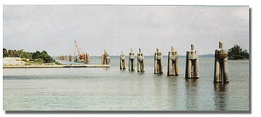 |
| Dolphin pilings |
The
lockmaster hailed the offending boat for about 5 minutes but got no response,
so he finally had to walk down the side he was on, across the closed lock gate,
and still further down the approach wall to talk to the boat’s captain in
person. I don’t know if the people on
the boat had been still asleep, but it took them some time to get going. Before they even appeared on deck, the horn
sounded warning that the railroad bridge would be closing. The lockmaster radioed them that they needed
to hurry if they didn’t want to be trapped between the lock and the
bridge.
When they finally cast off their
lines and pulled away from the wall, the bridge was closed and the train was
just starting across. As they passed us,
the captain seemed very exasperated by the whole affair and called out to us
that the bridge had been closed all night, which is why they had tied to the
wall. Although that seemed unlikely to
us, I have to believe that they would have rather been docked at the City Dock
with power if they had had a choice, so who knows?
We got through the Moore Haven Lock without further ado and
were soon on our way to Lake Okeechobee.
The canal between the lock and the lake is fairly narrow, bordered on
one side by marsh grass and the other side by a levee.
 |
| Okeechobee Waterway canal between Moore Haven Lock and Clewistown |
 |
| Snowy egrets in the marsh grass |
Clewiston, FL, is where you make the choice to take the
sharp left to go across the lake or to go straight to take the rim route. Since the lake level was up at 14.5 ft, and
going across is a shorter distance, we had already decided to forgo the rim
route. If we had had a smaller boat,
however, we probably would have taken the more protected rim route, because the
winds were forecasted to be 15-20 mph out of the NE, and wave heights were predicted
to be 5-6 ft.
 |
| Marsh grass starts to thin out as you get out onto Lake Okeechobee proper |
As soon as you make the turn at Clewiston to take the route
across the lake, the channel has marsh on both sides, which gradually thins out
as you get closer to the lake. We could
see that there were white-capped waves on the lake, but it didn’t seem too
rough, so we decided to see how things went, knowing that we could always turn
around and take the rim route if we thought it would be too rough. Although the waves were 3-5 ft, they were mostly
on our forward port beam, with a relatively short interval, so we didn’t rock
and roll as much as we did on our Gulf crossing. Since the wind was fairly stiff, however, we
had frequent sprays on water over the bow and even on our windows from time to
time. We met a couple of westbound sailboats as we crossed, but we
didn’t see any other power boats except for a smaller, faster one that came out
of Clewiston and was gone from sight before we even got to the lake.
 |
| Seagulls followed in our wake, occasionally swooping down on things in the water |
Since it was a little rougher of a ride, Rob did most of the
driving across the lake since it helps him to not feel seasick. Although it was a cloudy day overall, the sun
did come out during our lake crossing, so it didn’t seem as rough as it might
have if it had been cold and rainy.
Isn’t it funny how such a small thing can make a difference in your
perspective?!
When we got to Port Mayaca Lock at the east side of the
lake, the chamber was open and ready for us.
We were glad of that, because we weren’t looking forward to having to
idle around and wait since the lake conditions were a bit rough. There was some protection from the wind as we
got closer to shore, so the waves gradually became smaller the closer we got to
the lock, but there were probably 1 ft waves up until we got between the
approach fender walls. I came into the
lock at 7-7.5 mph, which is 2-3 mph faster than I normally would have in calm
conditions, but I was concerned about possible current and wind shifts at the
lock doors, so I wanted to have enough speed to maintain good steerage. Once I got inside the lock chamber, I quickly
slowed down, and we grabbed lines on the starboard side with no problem at
all. When the lock doors opened to the St
Lucie Canal, it was so calm and smooth that it was hard to believe how
different the conditions were on the other side of the lake-side doors!
 |
| There were a number of these "water corrals". We wondered if the fencing was a breakwater. |
 |
| Standing guard |
It was about 25 miles to our last lock, the St Lucie
Lock. When we arrived, there was a
westbound work barge preparing to lock through, so we had to wait about an hour
total until we could lock through ourselves.
Another boat arrived as we were waiting, and since it traveled faster
than us, it went into the lock first when the time came. Once we were through the lock, we began going
over the options that Rob had written out as to where to stay for the night.
 |
| The only large alligator we saw was in a residential area on a backyard boat ramp! |
Since it was later in the afternoon when we locked through
St Lucie Lock, we didn’t think we could make it to the AICW in time to get to
an anchorage and get to shore before sunset.
We decided to anchor at Pendarvis Cove, which was right across from the
Sunset Bay Marina where we had docked Tamure back in November. There was a boat ramp and fishing pier nearby
for easy access to shore for Sasha, so it worked out great. There were a lot of other boats already in
the anchorage since the cove has a large area of deeper water off of the
channel. We turned off of the channel
just before green DM 25 and had 8-10 ft of water the whole way in.
 |
| Pendarvis Cove anchorage |
We had passed a number of 8 person crew boats with coaches
following along in small power boats a couple of miles before, and when we took
Sasha to shore at the boat ramp, we noticed a number of people standing around
talking in the parking lot. Since they
were obviously not fishing or boating and it wasn’t an especially good day for
picnicking, I wondered why they were hanging around so long. Shortly after we got back to the boat, right
at sunset, the crew boats started coming in, headed for the boat ramp. Since the kids on the boats looked fairly
young – we have a hard time distinguishing between high school and college age
kids since they all look so young to us now – the people milling around the
parking lot were probably some parents.
 |
| Crew boats approaching the ramp |

Our solar panels had fully charged our battery banks since
we had about 3 hrs of full sun coming across the lake, so we didn’t need to use
our generators at all. We aren’t big
energy users, but we really like that we don’t have to worry about our
refrigerator and using a reasonable amount of lights and TV while at anchor.
 |
| Lights on the St Lucie River at night |
No comments:
Post a Comment