July 7, 2016
Only about 90 more miles to go and we would be in New Bern,
NC, our final destination for the summer!
We had plenty of daylight to get there today, but the Cunningham Bridge,
which was pretty much at the end of our journey, would be closed for rush hour
from 4-6 pm except for a single opening at 5.
If we didn’t make at least the 5 pm opening, then we wouldn’t have the
marina staff there to help us get in. We
really wanted to make it there before 4 pm though, because then the bridge
would open at our request, and we wouldn’t have to wait at all. We also wanted to make it to the Onslow Swing
Bridge before 7 am so that we could request an opening as soon as we approached
it rather than having to wait for the half hour opening. Normally, we would just adjust our speed if a
bridge has certain times for openings, but today we wanted as little wait as
possible because of the Cunningham Bridge schedule.
 |
| Rob squares away the fenders and lines as we get underway each morning |
We left the Swan Point Marina dock 15 minutes earlier than
our usual 6 am start time since we weren’t sure how strong the tidal current
would be. The Onslow Swing Bridge was 7
miles away from the marina, so it would take us about an hour to get there
unless we had a good push from the current.
The tide was in our favor, meaning that we were able to cruise at about
9 mph at our usual 1100 rpm’s, so we reached the bridge in plenty of time.
 |
| Onslow Swing Bridge |
 |
| Onslow Swing Bridge opening |
 |
| Water level indicator and informational signs |
Once we were through the bridge, we cranked up our rpm’s to
1200 – hold on to your hats! Even if we
could get an extra half a mile per hour, over 9-10 hours we would go an extra 5
miles or so. At our slow cruising speed
of 8-10 mph, that extra 5 miles would save us at least half an hour and could
make the difference of whether or not we reached Cunningham bridge by 5 pm.
 |
| Early morning fisherman (or is he really on security duty?) |
Part of the AICW, including Onslow Bridge, is on the Camp
Lejeune Marine Corps Base. My sisters
and I grew up in Jacksonville, NC, and since our father was a Marine, we had
had access to the base recreational facilities, including Onslow Beach.
 |
| My family may have used this beach bath house |
 |
| This off-duty marine with a cast net kept a sharp eye on us |
 |
| One of the few mile marker signs we have seen |
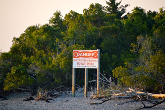
Since much of the waterway runs through a live firing range
with a multitude of signs warning of unexploded ordinance, I don’t think they
worry too much about unauthorized personnel landing in this area.
 |
| Fortunately, the lights weren't flashing, but there is a routine schedule for the firing range posted online |
 |
| Warning signs like this were posted quite frequently as reminders |
 |
| Looks like this would be a good fishing spot anywhere else |
Boaters have a variant of the phrase, “There are 2 kinds of [whatever
group you are a part of], those that have [done x, y, or z] and those that will,
at some point, [do x, y, or z].”
Although we had run aground in our dinghy, we had not yet done so with
Lorelei IV. We were about to move from
the 2nd group in the phrase to the 1st. Of course, we did have to pick a place with
warning signs telling you to avoid anchoring, beaching, and other ground disturbing
activities! Luckily we didn’t think
about that part of it until afterwards!

Whenever waterways come together, there is often the
possibility of shoaling where the current slows down enough that suspended
particles have time to settle out. Generally,
when you have a one that comes in at a near right angle to another waterway,
shoaling often occurs across from the junction since the incoming current would
hit the far bank and slow down. With
tides causing current to flow both ways in the AICW, it isn’t always easy to
predict where shoaling will occur.
We were approaching green daymarker 59, which is at the
entrance of Shacklefoot Channel. There
were 2 buoys near the bank across from the channel, so while we were still far
enough away that the angle of the morning sun made it hard to determine the
colors or shapes, I came to the conclusion that there were 2 red buoys marking
an area of shoaling across from the channel.
In hindsight, I should have wondered why there were 2 red buoys when 1
would have been plenty. Since green
daymarker 59 was also there on the other side, I felt confident that the main
AICW channel ran between the buoys and the daymarker.
Rob was on the bow, taking pictures of the scenery, when he
called out to me that there was a green buoy coming up on our left and was I
sure I was in the right channel.
Immediately, we both knew what was happening, and I pulled back the
throttles and then put the engines in reverse.
We still slid to a stop on the soft sand bottom – with no unexploded
ordinance – but by that time we were going slow enough that we were only
grounded softly. I powered the engines
in reverse to pull us off, but I was a bit flustered and gave too much power to
the port engine. This pushed our stern
toward the sand bottom that we had just gotten off of, and then we were
broadside to the current, which again pushed us up against the bottom. If we got good and grounded, then we would
have to wait hours for a tow and would definitely not make our desired bridge
opening!
It is times like this that sometimes I’m too close to the
situation to think straight, and Rob’s training and experience as a fire chief
allows him to see the overall picture and what must be done to achieve the
desired outcome. He took over the helm,
got us off of the sand shoal, and back on track. He backed up a short ways past green
daymarker 59 so that we would have room to get up some maneuvering speed in
order to wind through the green and red buoys near the port bank. Now we could check that one off of our list
and could breathe a sign of relief that it went as well as it did!
 |
| Stern view of the green daymarker on the left and our path through the red and green buoys on the right |
 |
| More warning signs |
 |
| Channel through the off-limits salt marsh |
 |
| Finally, the end of the firing range |
From Camp Lejeune to Morehead City, it was a bit of a
homecoming for me, seeing familiar sights although from a different
perspective. My family and I had spent
quite a bit of time on the beaches along this part of the waterway, so my
pictures may not mean much to others, but they bring back fond memories.
 |
| Emerald Isle Bridge |
 |
| Emerald Isle |
 |
| Atlantic Beach |
I don’t remember going to Morehead City while I was growing
up, even though it really wasn’t that far away, but the world seemed bigger
back then than it seems now. Driving an
hour somewhere was a big trip, so you had to have a good reason for taking it. Even though I knew Morehead City was a
seaport, I had thought that it primarily supported the fishing and shrimping
industries, so I was surprised to see large cargo ships in the harbor.
 |
| The big ships were docked but there were plenty of small craft around |
 |
| This one had alot of pipes on top, so maybe a tanker of some sort? |
 |
| When loaded, the ship's bulbous bow sits below the waterline so that it reduces drag by modifying the flow of water along the ship |
Once we passed through the Morehead Railroad bridge, we were
in a rather wide waterway called Harlowe Creek.
 |
| The Morehead Railroad Bridge is kept open unless a train needs to cross |
 |
| We had to wait our turn and weave around the boat anchored in the approach channel |
We saw a couple of shrimps boats which were headed in along a different
route which would eventually intersect our path, so we figured they had either
come in through Beaufort Inlet or had been shrimping in one of the sounds.
 |
| Shrimp boats headed into their docks |
We also saw some boats that were working in Harlowe Creek
itself.
 |
| Capt Dump III |
 |
| Crew of the Capt Dump III |
 |
| When the nets are down in the water, gulls follow along to swoop down on fish that come up to the surface |
 |
| Shrimp boats docked along Adams Creek Canal |
Soon, we entered the Adams Creek canal, which connects the
Morehead City waterways with Adams Creek and, eventually, the Neuse River. The creek is a popular recreational area, so
we saw a number of small marinas, boat ramps, parks, and boaters of all kinds
as we went along.
 |
| Fisherman with a cast net |
 |
| Ready for an extended time out on the water |
 |
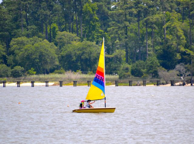
| My sisters and I sailed Sunfish like this on the inland waterways of Camp Lejeune |
 |
| Coast Guard hard at work, protecting the waterways in a number of ways |
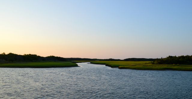
When we reached the Neuse River, we were surprised how wide
it was. The AICW continues on seaward,
past Oriental, NC, and since we were headed upriver, we said a fond
farewell. We are grateful for its
well-marked, protected waterways, which have made our travels so much easier
while also providing interesting and beautiful scenery.
The rest of our journey up the Neuse River to New Bern was
almost anti-climactic, because it went so smoothly and we were on schedule to
make it to the Cunningham Bridge well before 4 pm. The Neuse river is not only wide but remains
fairly deep, so we could relax and enjoy the sights for the hour and half or so
that it took to reach the NC Highway 17 Bridge.
The approach to the bridge runs closer to the right descending bank but
is clearly marked.
Since the Cunningham Bridge is only about ¾ of a mile from
the NC 17 Bridge, we radioed on VHF Ch 13 to request an opening as soon as we
started through the NC 17 Bridge fenders.
As soon as we made the turn to start our approach of Cunningham Bridge,
the bridge tender began to open it, so it really couldn’t have gone more
smoothly. The dockmaster was there to
talk and wave us in, so after a short wait while another boat ahead of us got
in and docked, we headed into the marina ourselves.
The entry into the New Bern Grand Marina is somewhat of an
acute angle such that you have to approach the nearby Trent Railroad Bridge in
order to get a bigger boat turned on the best line of approach.
Since it was our first time in and there was
a bit of a wind pushing us toward the marina, the entry and fairways seemed
narrower than they really are.
We wanted
to do a port side tie to the inside of the long floating face dock, so that
meant I would have to get turned around.
I was concerned about the wind, but with Rob’s encouragement and
guidance, we “got ‘er done”.
 |
| New Bern Grand Marina |