July 4, 2016
A sailboat had come in late in the evening and had docked in
front of us, so leaving Beaufort this morning was a bit of a challenge for us,
at least in the planning and worrying phase.
First, we wouldn’t have any dockhands available to help us since we like
to leave at first light. Second, the
current would be fairly strong on our stern since the tide was in the middle of
its incoming phase, meaning that it would be trying to push us into the
sailboat as soon as we released our lines.
Third, we couldn’t back straight up, because there was a boat behind us
as well.
We discussed strategies and decided that since you usually
have more control if you are pushing against a current in close maneuvering,
Rob would release the stern line first so that I could pivot the stern out and
back out into the current. We were so
concerned about getting our lines released in the right order though that we
almost forgot to undo our power cord! That disaster averted, we put our plan into
action and it worked! Rob released the
stern line and I made sure I had control of the boat, starting to pivot the
stern out. Then he released the midship
line, and I continued pivoting while starting to back out as soon as I had
enough clearance from the boat behind us.
Finally, he released the bow, and I continued backing out until I felt I
had enough clearance in front to start moving forward. High fives all around for good teamwork and
getting out safely!
 |
| Old Glory flying on our stern |
We had thought about just going to Charleston, SC, since it
was in our middle range of 70-80 miles, but when Rob had called the marinas
there on Saturday, they were already all booked up for the 4th. He had moved further out until he found a
marina in McClellanville, SC, which had a space available, so we would be going
about 100 miles today. If for some
reason, the timing didn’t work out, there were anchorages available along the
way as alternative stopping points.
 |
| Moorings for large ships near one of the larger rivers |
 |
| These large gray ships have a landing platform in the front that can be raised and lowered. |
 |
| The Georgia Queen riverboat getting some work done |
There were 7 bridges along our planned route. Four of them were 65 ft fixed bridges and the
other three had heights of 30, 31, and 31 ft at mean high water, so we wouldn’t
have to have any openings which could possibly delay us. Hooray!
This part of the AICW has a number of narrow cuts, which
connect points of the rivers and creeks that meander through the area, thus
shortening the distances you might have otherwise had to travel. The notorious Elliot cut is the half mile of
the AICW that connects the Stono River with the Charleston Harbor area. The cut can have strong currents, depending
on the state of the tide, so under-powered boats often wait until the tide is
in their favor or slack – falling tide if northbound, rising tide if southbound
– before going through. Some boaters
recommend making a “Securite” announcement on VHF Ch 16 before entering the
cut, so that other vessels in the cut will know that another vessel is entering
and can announce their positions if there is a concern.
 |
| Note the narrow man-made waterways connecting the rivers and creeks, allowing you to go in a fairly straight line across rather than having to follow the wandering path of the natural waterways to get to the same point |
Since the cut is really the only good alternative for
getting from Charleston to the Stono River, I’m sure that there is typically a
lot of boat traffic normally, but on July 4th, whoa! There were a few larger boats like ours from
time to time, but hundreds of small and medium run-about boats, not to mention
jetskis, in that long half mile. Most of
the small boats, of course, were going just about as fast as possible -- unless
they decided to almost stop mid-channel for no apparent reason at all.
At some point before we had reached the Elliot cut, our Garmin chartplotter started acting up, completely losing our position so that it looked like we were going across land if you looked at the screen. Rob thought for a minute that he had missed a turn and was headed down a side channel! This has happened twice before and neither we nor the company knows why. The only solution is to unplug the power cord from the unit, wait a few minutes, and then power it back up. This is why we have 2 more completely independent navigation programs running when we are underway, so we have a backup for our backup.
We arrived at the south entrance of the cut around 1 pm, and
the tide was falling, so we had that in our favor. The very first portion of the southern end of
the cut looks quite narrow, but there is actually plenty of room for boats to
pass, fortunately for us since we were sure to meet lots of boats even in this
short section. Because it is more narrow
here than other parts of the cut, the current was strong, our speed hitting
12-13 mph at times, even though I throttled back to 900 rpm’s. You don’t want to throttle back too much when
a current is pushing you though, because you need to maintain steerage.
 |
| Narrow portion of the Elliot cut |
Once we were through that first narrow portion, the cut
widened out somewhat and our speed decreased.
There was a small No Wake Zone shortly after the current decreased, so
we had to watch out for the small boats meandering about in front of us, as
well as the Water Patrol boats out doing safety checks. Since I had been at the helm for a while
before entering the cut, Rob took over about half way through. He asked me if navigating the narrow,
relatively shallow channel was stressful, and I answered that it wasn’t so much
the narrow channel as much as watching out for the other boaters. After driving for a little while, he agreed
wholeheartedly with my assessment.
When we finally got to the Charleston Harbor and inlet area,
we were glad that we wouldn’t be staying there.
Not only was the water busy with small boat traffic, but there were
large commercial vessels and lots of sailboats now too! The windy conditions made for a moderate chop
as the harbor widened out toward the inlet, so small boat traffic dropped off
somewhat.
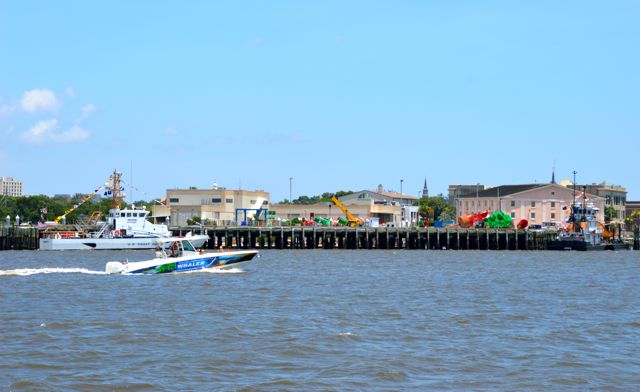 |
| Busy Charleston Harbor |
 |
| Coast Guard ship at dock |
 |
| Huge ocean inlet buoys |
Fort Sumter sits at the entrance to Charleston Inlet, and
there were a number of shuttle tour boats going to and from the fort. These seemed to keep out of middle of the
harbor for the most part, probably pointing out points of interest along the
tour route before reaching the fort.
 |
| Princess Cruiseline ship at dock |
 |
| Large cargo ship moored in the large ship mooring area |
 |
| Fort Sumter sits on the south side of the inlet |
Finally, we were through the inlet and aimed toward the AICW
channel on the other side when we noticed a run-about boat anchored fairly
close to the entry. Since there were
other boats also traversing the area in and out of the channel, it was really a
poor choice for a spot to anchor. We
don’t know if the boat had been there long or perhaps had had a problem that
needed taken care of, but as we approached, they were pulling the anchor up, so
they either got the issue resolved or they decided there was too much traffic
passing too closely by them.
After the excitement of the Elliot Cut and Charleston, the
next 4 hours or so that it took us to get to McClellanville was welcome,
peaceful cruising. We passed several
marinas that Rob had also considered as places to stop, most of which seemed to
have more challenging entries or tight quarters, so we were glad to be moving
on.
 |
| We've seen dolphins playing in our bow wake every day so far |
We arrived at Leland Oil Company, McClellanville, SC, around
5:30 pm. Rob had called ahead to keep
the dockmaster informed of our progress and to assure him that we could
probably get ourselves docked if it got too late for him to wait around. The dockmaster, who was a member of the
Leland family, had told Rob that he had a boat with engine trouble coming in at
around the same time, so he would be there anyways.
The entry to the small creek where the marina is located is
very easy and there is plenty of water the whole way in – 11-14 ft at medium
tide. Leland Oil company supplies fuel
and dockage to a number of shrimp boats, so their diesel price was competitive
with other fuel docks in the area. Most
of the shrimp boats were rafted off together at a dock further up the creek, but
there were a couple of them rafted together on the long floating face dock
which is the majority of dockage space at the marina. After we got turned around and docked in
front of the two shrimp boats at the west end of the dock, we started fueling. About half-way through fueling, the other boat
arrived, so Rob went to help get them in since they were coming in on one
engine. The captain did a great job even
on one engine, so Rob was back pretty quickly to help complete the fueling.
 |
| Jeremy Creek has plenty of water leading to Leland Oil Co marina |
McClellanville is a nice quiet small town, perfect for us but
maybe not so great if you want more services.
The people on the boat with engine trouble needed to get something for
supper, so the dockmaster told them that if they took a walk around town,
someone was bound to invite them to their 4th of July backyard
barbeque, seeing as how it was a very friendly town. When they seemed hesitant about that idea, he
gave them a ride to the local Dollar General since it was the nearest place
that was still open.
When they returned, we invited them over to our boat to visit
for a while. We convinced them to stay
for a grilled burger supper since they had only found frozen dinners to buy, so
spent the rest of the evening getting to know our new acquaintances, Bob and
Sally.
They had picked up their boat in Manteo, NC, and were taking
it back to Stuart, FL, where they lived.
Bob had gotten the boat from a friend’s widow after he died from
cancer. The friend had liked to work on
the boat’s systems during his battle with cancer, but the boat had not left the
dock for 7 years. Many of the projects
were unfinished, so the widow couldn’t sell the boat and didn’t want the worry
of it any longer. Since Bob has been
around boats all of his 60+ years, he agreed to see if he could get the boat in
working condition, after which he would take it back to Florida. The AC didn’t work and one engine had quit
working 2 days before, but he and Sally were still game to continue their
journey. Bob said that he knew what part
he needed to fix the engine and now it was just a matter of finding it once
they got it back to Stuart.
It was Sally’s first time cruising on a big boat, and it
sounded like she was doing fine. In
fact, their Garmin chartplotter had quit working while they were on the Pamlico
Sound in a storm, and Sally figured out how to use Google Earth to determine
their position, taking over the helm until they were in the protection of the AICW! It sounds like Bob has found himself a great
first mate in Sally! They weren’t sure
what the issue was with the Garmin, but eventually Bob got it to start working
again.
The evening finished out perfectly with a shrimp boat across
the channel shooting off a few fireworks for about half an hour. It seemed to be an idyllic small town scene
with a small group gathered under the large tree in front of the marina office,
playing guitar and socializing rather than blasting a radio and being rowdy.
No comments:
Post a Comment