May 22-23
The trip from No Name Harbor to Marathon is about 115 miles,
so it would take us about 13 hrs if we could cruise at 9 mph. First light would be around 6:15 am and last
light around 8:30 pm, making for about 14 hrs of daylight at this time of year
and not leaving much leeway. We set an
alarm so that we would have enough time to check the weather and sea conditions
one last time, take Sasha to shore, and still weigh anchor by first light. Our weather window was forecasted to be
closing up by the end of the day, so we had to decide whether to go ahead and
leave as planned or whether to stay another 5 days or so for the next
window. Since Florida Bay was still
forecasted to be calm, we decided that we could duck inside at several points
if conditions got too rough for us.
We thought we were doing well to leave by 6:15 am, but the
sailboat in the anchorage left about 20 minutes before us. We had read that the inlet at No Name Harbor
could be a bit bumpy, so we were glad to be going through it in good
light. Wave heights were about 3 ft at 4
second intervals, so it was, indeed, a bit rolly after we turned to head more
south since the waves were on our beam.
Conditions smoothed out around 8 am as forecasted, so we started to
settle in for a nice, uneventful cruise.
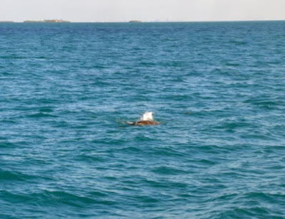
Just about that time, I noticed something in the water
directly ahead, bobbing up and down. At
first I thought that someone had lost a life jacket or fender, but since it
looked like 2 separate components at times, I thought “Oh great, the only crab
pot in this area and we’ve programmed our course to go right over it!” I changed course to dodge around it, swinging
wider as we got close enough to recognize exactly what it was. Apparently, during sea turtle nesting season,
the turtles mate right offshore and then the females go ashore to lay their
eggs a few weeks later. So from March 1
to October 31, if you see something bobbing on the surface a few miles
offshore, you may be able to see turtles mating, just as we did. We saw 3 pairs within a couple of hours, and
I think we could have gotten closer if we had slowed down, but we didn’t want
to disturb them.
 |
| We didn't get a very good picture of the mating turtles, but you can see why it would be hard to figure out what they were until you were closer. |
Hawk’s Channel runs about 2-4 miles offshore, so you are
always within sight of land. Boat
traffic was light in both directions, so we only passed by other boats 3-4
times an hour. Some of them traveled
quite fast, able to make the same trip as we in 2-6 hours, but we don’t really
envy them since they burn through a lot of fuel in order to do so, and probably
miss seeing things like mating turtles.
We also saw a lot of fishing boats and dive boats going in and out at
inlets, but they zipped across our path before we even got close to them.
 |
| Large boat headed south too |
We were approaching Channel 5, one of the inlets into
Florida Bay that can accommodate larger boats, so we had to make a decision
about whether to continue on the ocean or whether to go into Florida Bay. The wave heights had only gotten a bit bigger
– 1-2 ft rather than the 0.5-1 ft we had been enjoying most of the day – so we
would still be comfortable if they didn’t get too much bigger. We still had about 4 hours to go, however, so
since the waves were forecasted to get to at least 3 ft and were on our beam,
we decided to head into Florida Bay through Channel 5.
 |
| Channel 5 Bridge |
The water depths in Hawk’s Channel had been 10-20 ft, while
depths in Florida Bay along the AICW at MLW (mean low water) could be as low as
6 ft, according to our charts. Since
Lorelei IV only drafts about 4.5 ft and the tide was rising, we were reasonably
confident that we wouldn’t run aground as long as we stayed in the channel in
areas of lower depths on our charts.
 |
| NOAA chart showing the relatively shallow depths of Florida Bay near Marathon |
The water in Florida Bay was calm and smooth compared to the
Atlantic, and depths were 6.5-8 ft for the most part, so we were glad that we
had chosen to finish our trip on the inside.
As we were passing under the Channel 5 Bridge, a fisherman in a nearby
boat got a good-sized fish on that took his line was across our path. Another person in the boat was backing it up
to follow the fish, so we almost came to a stop for a minute or so until they
could get clear. It would have been cool
to hang around to see if he was successful in catching the fish and what kind
it was, but since we didn’t want to run out of daylight, we got underway again
as soon as the way was clear.
We had a few somewhat anxious moments when the depths
dropped as low as 5.2 ft at a couple of narrow passages in the channel, but
since this lasted only a few seconds and then quickly got deeper again, we
figured it was just a little sand shoaling in areas that are apparently prone
to it. The only other excitement we had
was when a pod of dolphins came to play in our wake for a while, and we could
see them very well due to the great water clarity and relatively shallow depth.
 |
| Dolphins playing in our wake |
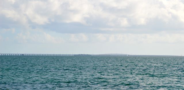
7 Mile Bridge was our landmark for nearing the end of our
trip and we could see it for a quite a while before we finally reached it. Once we passed under its tall span, the water
got a little rougher, once again confirming for us that we had made a good
decision to travel on the inside for the last few hours of our trip. Once we were in the approach channel for Boot
Key Harbor, the water calmed down again, making for an easy entry. The channel through the Harbor to the
Marathon City Marina mooring field is well-marked, so we had no trouble finding
our way.
 |
| 7 Mile Bridge |
The City Marina does not accept reservations for moorings,
assigning them on a first come, first serve basis when boats are actually in
the Harbor. Since we would be coming in
after the office was closed, we were told to call back a few minutes before 5
pm. If there was still a mooring available
for our size boat, then they could assign us one at that time. Fortunately for us, since many boats head
north for hurricane season, there were 3 moorings available in the part of the
field that can accommodate boats larger than 45 ft. Even though we thought that our mooring would
be in the first row that we would come to, we were confused for a moment,
because one of the buoys marking the edge of the mooring field was close to
that row and had a different letter on it.
We finally saw the ‘W’ that we were looking for when we looked closely
at the first mooring ball in the row. We
were assigned to W-5, so then it was just a matter of making our way down the
fairway until we found it. Rob had no
trouble picking up the pennant, passing our 2 lines through the eye and
securing them before the boat even had a chance to drift back on them. It’s so nice when we look like we actually
know what we’re doing!
 |
| Lorelei IV on mooring ball W-5 |
One nice thing about being on a mooring ball is that we don’t have to wait to make sure we are secure like we do when we anchor. Since it would be getting dark shortly, we
quickly deployed the dinghy and took Sasha for her walk ashore. There is a nice park close to the marina, so
we found a nice patch of grass for a Frisbee session.
 |
| One of the dinghy docks at Marathon City Marina |
We got all checked in at the office the next morning,
getting our welcome bag, dinghy tag, and parking tag for our truck. It was just a short walk to the storage lot
where we had put the truck a couple of weeks before, and along the way we found
another small park as a back-up for Sasha in case the one near the marina is
too busy.
 |
| Sasha loves to play Frisbee |
 |
| We have to make her take breaks when she looks like she's getting hot |
No comments:
Post a Comment